Image Collection
An NSF/International Digital Library Project. Editor in Chief: Ching-chih Chen, Simmons College


Traditional Search
Random
Browse

Powered by

   IMCS
GMNet | Simmons | NSF

Content-Based Search

Powered by

   SIMPLIcity
Stanford | Penn State | NSF


Home


Semantic is ON (change)

24 images match your selection. Each page shows up to 200 images.
Chou-kïang or Canton River
Similar | Larger | Info
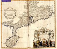
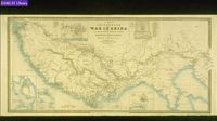
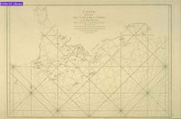
Carte D'une Partie Des Cotes De La Chine Et Des Isles Adjacentes
Similar | Larger | Info
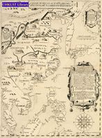
Sinarum Regni Alioru[m]q[ue] Regnoru[m] Et Insularu[m] Illi Adiacentium Descriptio
Similar | Larger | Info
Plan of the Attack & Bombardment of Canton
Similar | Larger | Info
China Sea
Similar | Larger | Info
Descripcion De Las Indias Del Poniente 14
Similar | Larger | Info
A Correct Chart of the China Seas
Similar | Larger | Info
Canton and Its Approaches, Macao and Hong Kong
Similar | Larger | Info
Partie De La Chine
Similar | Larger | Info
Prima Tavola
Similar | Larger | Info
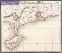
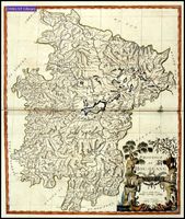
Iunnan, Queicheu, Quangsi Et Quantung: Provinciae Regni Sinensis, Praefecturae Dictae
Similar | Larger | Info
Province De Quang-tong
Similar | Larger | Info
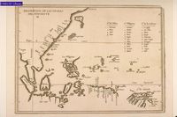
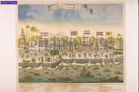
Carte Des Isles Qui Sont a l'entrée De La Rivière De Canton
Similar | Larger | Info
A Survey of the Tigris from Canton to the Island of Lankeet
Similar | Larger | Info
Vüe De l'entrée Du Bocca Tigris, Conduisant à Canton
Similar | Larger | Info
This Map of Asia
Similar | Larger | Info
Vista De La Gran Ciudad De Canton En La China
Similar | Larger | Info
Quantung, E Fokien: Provincie Della China
Similar | Larger | Info
Land, Taffel Der Insel Sanciano
Similar | Larger | Info
A Plan of the City of Canton on the River Ta Ho
Similar | Larger | Info
Province De Hou-quang
Similar | Larger | Info
A Map to Illustrate the War in China
Similar | Larger | Info
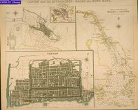
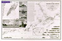
Die Chinesische Küste :Dder Provinz Kuang-tung, Zu Beiden Seiten Des Meridians Von Macao
Similar | Larger | Info
Terza Tavola
Similar | Larger | Info